California Gap Analysis Overview
(please visit the original website for reports and data products)
Numerous efforts are underway by public and private groups to assess the status of biodiversity in California. Most are being conducted at local to sub-regional scales, and many are focused on species or communities of special concern. Previously lacking has been an overview of the management status of species and communities both statewide and in the western U.S. as a whole. Our Geographic Information System (GIS) -based Gap Analysis of biodiversity in California is part of a national Gap Analysis Program (GAP) which coordinates state and regional gap analyses being coordinated by the National Biological Service.
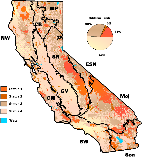
The term "Gap Analysis" refers to the evaluation of the management status of plant communities, vertebrate species and vertebrate species richness by GIS overlay of biological distribution data on a map of existing biological reserves. Maps are produced at relatively low spatial detail (e.g., 1:100,000 map scale) to provide a broad overview of the distribution of biota and their management status, and to identify landscapes that contain large numbers of potentially unprotected vegetation types and vertebrate species. Such areas can then be studied in more detail as candidates for additional management and conservation efforts to fill gaps in the reserve network.
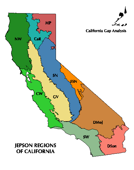
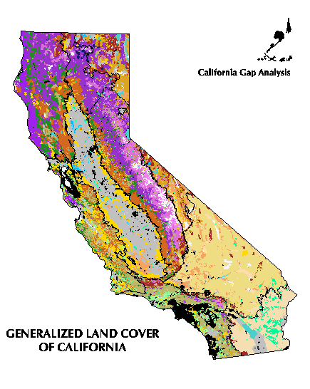
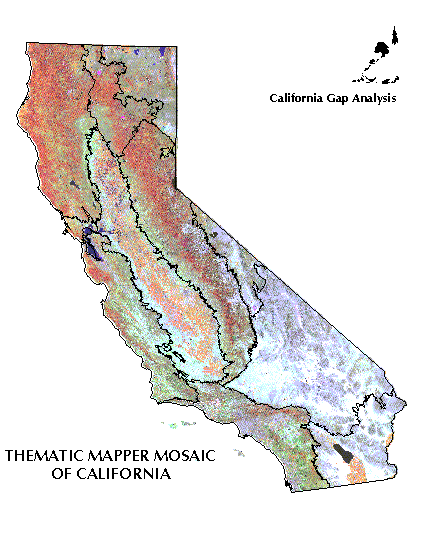
Because of the California's size and complexity, we conducted our analysis on an regional basis, using the ten major regions of the state as defined in The Jepson Manual of Higher Plants of California (J. C. Hickman, editor; University of California Press, 1993) An up-to-date vegetation/land-cover map has been produced for each region using digital Thematic Mapper (TM) satellite data.
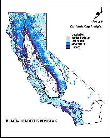
Image interpretation was guided by vector overlays of existing vegetation maps, land use maps and forest inventory data. Upland types were mapped with a minimum mapping unit (MMU) of 100 hectares (247 acres). Major wetland areas were mapped using a 40 hectare (99 acre) MMU, and smaller wetlands are encoded as attributes of larger upland polygons. The California Wildlife-Habitat Relationships System (WHR), in conjunction with digital species range maps, was applied to the vegetation map to predict the current distribution of potential habitat for each native terrestrial vertebrate species (455 species). For an example, see the map of the predicted distibution for the black-headed grosbeak . Land management was derived from maps of land ownership that we updated and classified into management status levels.
The project has been funded by many government and corporate sponsors and supported by many cooperators who have shared data and expertise. Many people worked to produce the CA-GAP database.
To learn more about the concept of Gap Analysis, visit the National Gap Analysis home page at the University of Idaho, or see Scott et al. 1993, in Wildlife Monographs
Find out what is being done in other states and ecoregions.